Postbridge Clapper Bridge: Visiting Guide, Access & Nearby Walks
Visit Postbridge clapper bridge on Dartmoor: how to find it, how long to stay, access and safety notes, and easy walks nearby. Check live notices first.
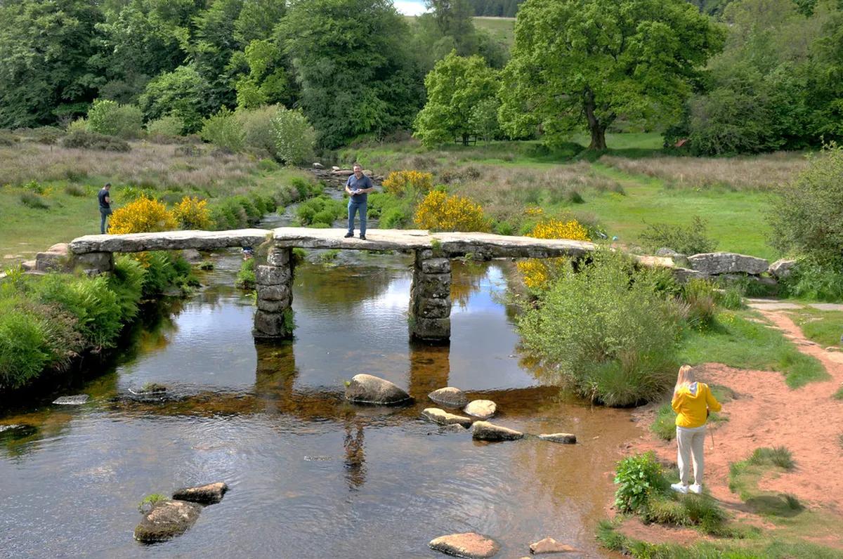
Last updated November 2026: Postbridge clapper bridge is a medieval-style granite slab crossing over the East Dart River, beside the B3212 in central Dartmoor. It is free to view and sits next to the road bridge, so a stop can take as little as 10 minutes. Our parent guide to 10 Best Things to Do in Dartmoor National Park covers the wider area.
Featured image: M McBey, CC BY 2.0, via Flickr.
Postbridge clapper bridge at a glance
Large granite slabs rest on stone piers over the East Dart here. Looking costs nothing, because it is a public outdoor structure. Plan 10 minutes for a look and a photo. Allow 45 to 60 minutes if you add the visitor centre and the riverside path. Steps at both ends and an uneven deck mean it is not a step-free crossing.
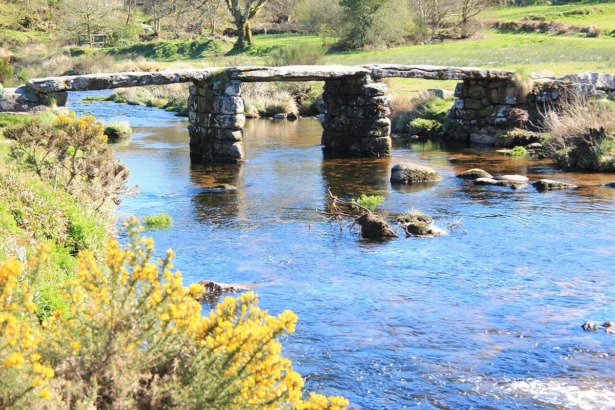
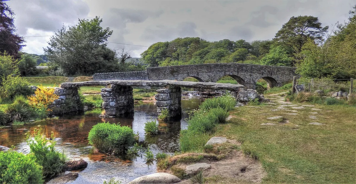
- What it is: a low granite footbridge, medieval in form, for walkers only.
- Where it is: Postbridge, on the B3212, just beside the road bridge.
- Cost: free to view.
- Time needed: 10 minutes for a quick stop, up to 60 minutes with extras.
- Access caveat: steps at both ends, no railing, slippery granite when wet.
What a clapper bridge is, and how to read this one
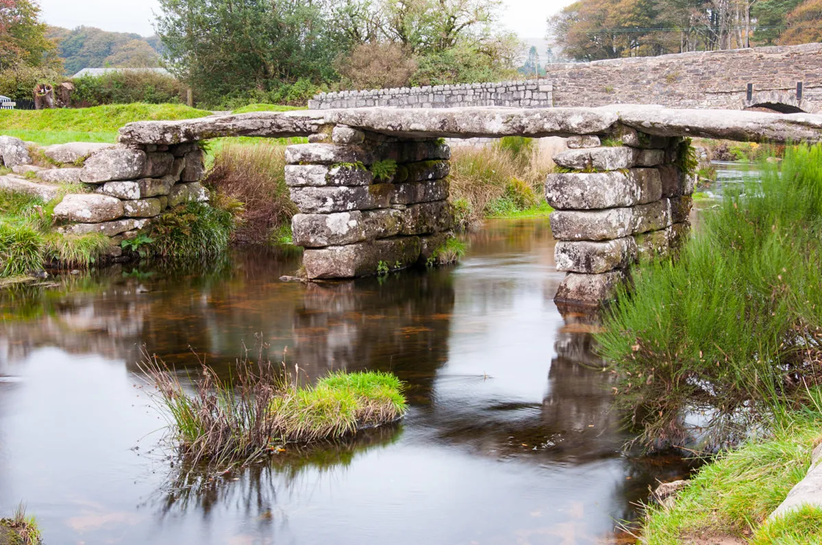
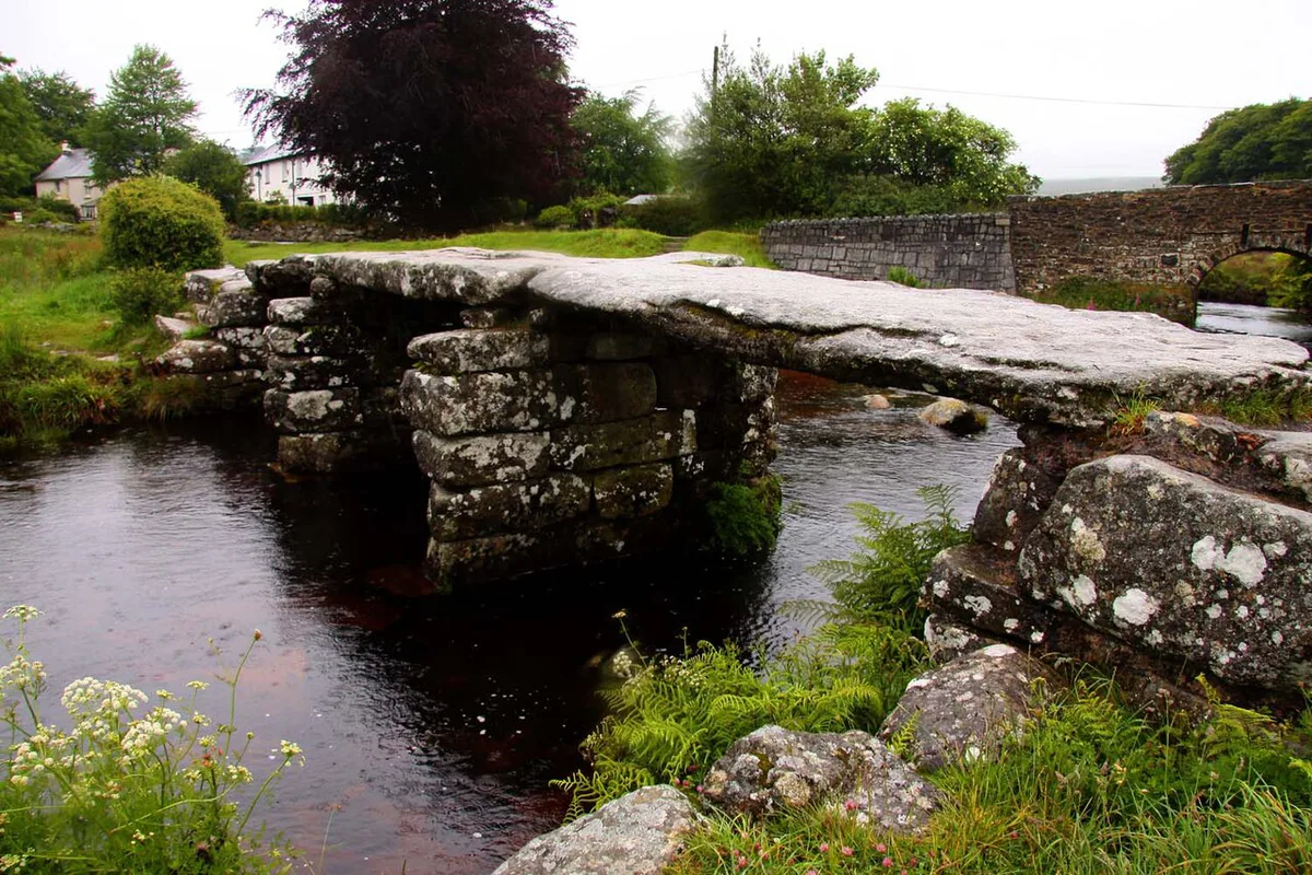
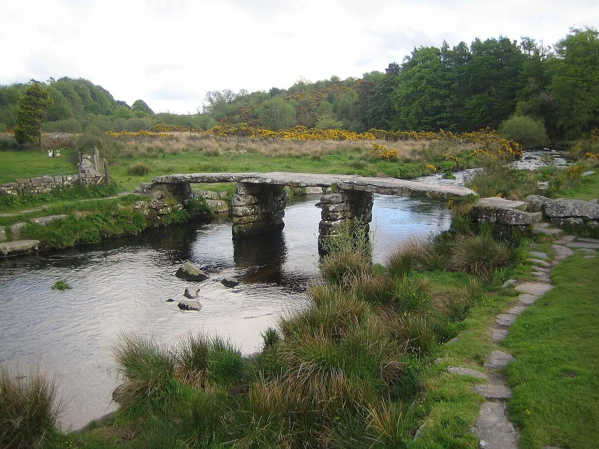
A clapper bridge uses large flat stones to span a river, resting on stacked or dry-stone supports. Foot passengers and packhorses used such crossings where a ford was awkward. At Postbridge, the piers are built from horizontally laid slabs. The deck is about 1.5 m wide, which is why it suits walkers rather than vehicles. Published descriptions disagree on the count. Some report three slabs on two piers, while others report four slabs on three piers. Check the Historic England listing before quoting a figure. Origins are often given as the 13th century, but that date is uncertain. Much of the surviving stonework is thought to date from after 1670, when the bridge was already reported in decay. Treat it as a long-used crossing with a later history rather than a single unchanged medieval structure. Avoid claims that it is the finest or the only one of its kind unless an official source says so.
Finding the bridge and parking
Postbridge lies on the B3212, and the clapper bridge stands about 20 m from the road bridge. Look beside the higher road crossing for the low, flat granite structure. The road bridge is a separate crossing, reportedly built around the 1780s. Parking is at the National Park visitor centre car park, a short walk of about 0.2 km away. Charges and seasonal changes are listed by Visit Dartmoor, so check there before you leave. Our Dartmoor Map: Where Things Are and Which Map to Use helps you place Postbridge among the surrounding moorland roads. Download an offline map before you go, since moorland signal can be patchy.
How long to spend at the bridge
Most visitors need a short stop. The table below shows how the time can stretch if you add the walks and facilities nearby. Each distance to a walk is measured from the bridge, not from the car park.
Wistman's Wood Walk runs 1.3 hr, yet it sits 5.5 km from the bridge, so it suits a half-day plan with a car rather than a quick stop.
| Time | What fits | Best for |
|---|---|---|
| 10 minutes | Look from the road side, take one photo | Drivers crossing the moor |
| 45 to 60 minutes | Bridge, visitor centre 0.2 km away, riverside path | Families and first-time visitors |
| Half a day | Bridge plus a nearby walk such as Bellever Forest or Wistman's Wood | Walkers with a car |
How to see it properly
Three viewpoints show the structure well. Start on the riverbank, where the stacked piers and the gaps between slabs are easiest to read. Then walk onto the deck, remembering it has no railing. Finish on the far bank to see how the deck stones meet the piers. For a photo, frame the bridge low across the water with one pier visible underneath. A straight-on view records the whole structure. Leave the modern road bridge out of the frame if you want the historic slabs to stand alone.
Access, safety and weather
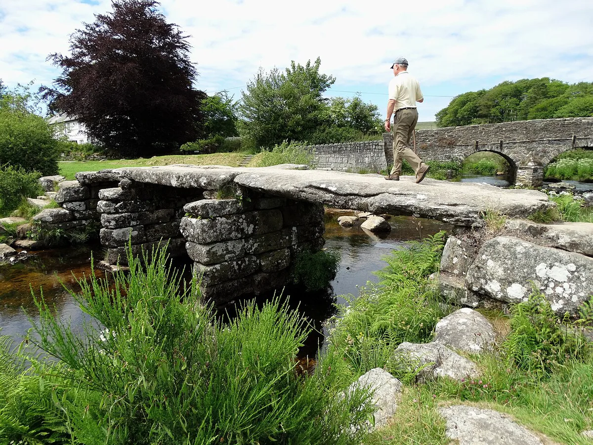
Steps lead up to the deck at both ends, and the stone surface is uneven. Granite turns slippery when wet or icy, so view the bridge from the bank if the surface looks unsafe. There is no railing, and the crossing is about 1.5 m wide. Skip the deck if you use a wheelchair, push a buggy or have limited balance. The riverbank view still shows most of the construction. Moorland conditions change quickly, so read the Dartmoor weather guide before heading out. The Met Office forecast gives current conditions. Before walking onto open moor, check Dartmoor National Park Authority advice and Ministry of Defence range-firing notices. Fire-risk warnings can also apply, and open fires and barbecues are not allowed on moorland when the risk is high.
- Crossing in wet or icy conditions.
- Confusing the road bridge with the clapper bridge.
- Expecting a toilet at the bridge itself.
- Planning a long visit to a short stop.
- Walking onto the moor without checking weather and firing notices.
Facilities nearby
Public toilets are at the National Park visitor centre, about 0.2 km from the bridge. An adapted toilet and baby changing are also reported there. Treat them as nearby facilities, not bridge amenities. Check opening times on the official visitor information pages. Food and drink options include the Warren House Inn, 3.3 km away. Runnage Farm Campsite lies 2 km away and has no hookups. For rooms and longer stays, see our guide to Hotels in Dartmoor: Where to Stay by Base & Budget.
Walks and sights near Postbridge
Postbridge works well as a base for short walks. The table lists trail lengths and times, with distances measured from the bridge. Verify current trail conditions before setting out.
| Walk | Length | Time | Effort | Distance from bridge |
|---|---|---|---|---|
| Gunpowder Trail to Powdermills | 6.1 km | 2.5 hr | Challenging | 0.2 km |
| Bellever Forest Easy Access Trail | 0.6 km | 15 min | Easy | 1.9 km |
| Potter's Walk | 1.2 km | 45 min | Easy | 5.4 km |
| Wistman's Wood Walk | 4 km | 1.3 hr | Easy | 5.5 km |
| Hexworthy Walk | 5.6 km | 2.5 hr | Moderate | 6.3 km |
- Bellever Forest, 1.9 km away: riverside picnics and working woodland.
- Bellever Tor, 2.5 km away: a summit walk past hut circles, covered in our Dartmoor tors guide.
- Wistman's Wood, 4 km away: twisted oaks among mossy granite boulders.
- Grey Wethers stone circles, 4.3 km away: two Bronze Age circles.
- Fernworthy stone circle, 5.3 km away: a small ring within a wider prehistoric landscape.
Combine it with a wider Dartmoor day
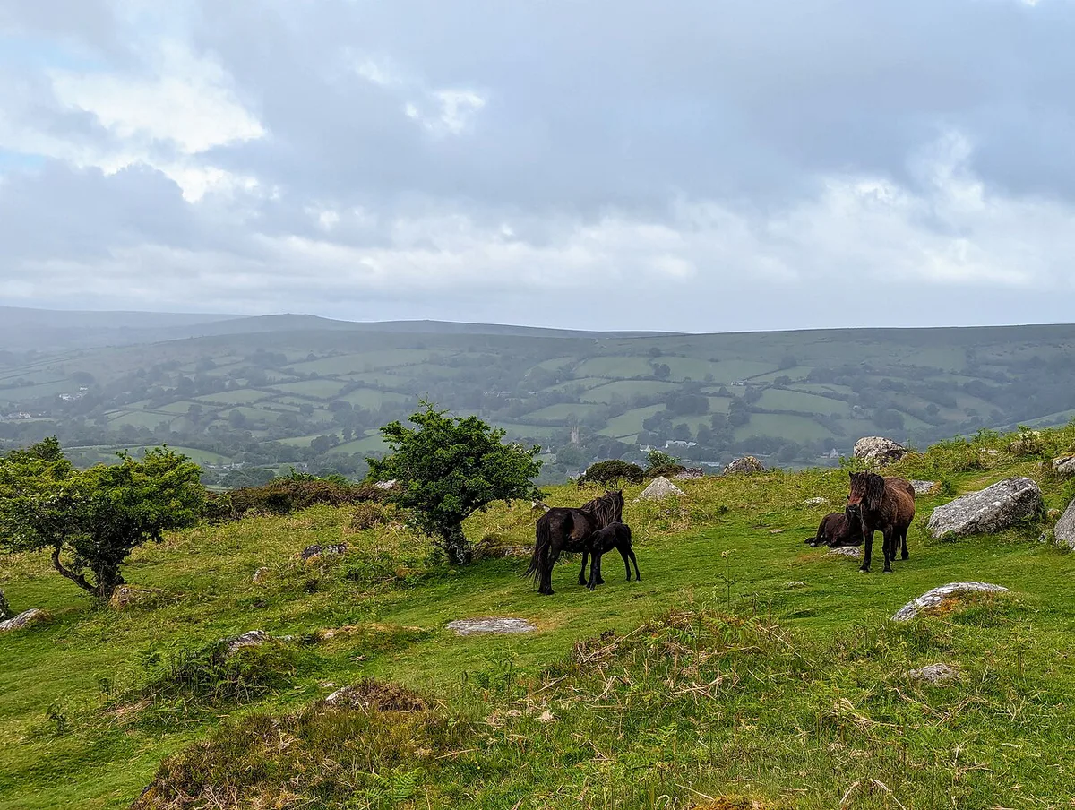
Postbridge sits in the middle of the moor, so it pairs easily with other stops. Add Princetown for a high-moor village stop. Choose Widecombe-in-the-Moor for a village-centred afternoon. Keep an eye out for grazing animals on the roads, and read about Dartmoor Ponies: Where to See Them and How to Act before you drive. Check road conditions and parking on the day, particularly in winter.
Frequently Asked Questions
What's at Postbridge, Dartmoor?
Postbridge has the granite clapper bridge over the East Dart River, a road bridge beside it and a National Park visitor centre about 0.2 km away. Bellever Forest is 1.9 km away, and Wistman's Wood is 4 km away.
Notes for your next park visit
Optional updates to our national park guides.
Read next
Keep planning
Picked from the same area