7 Best Things to Do in Peak District National Park
Plan the Peak District National Park: Dark vs White Peak, base towns, caves, trails, getting there without a car and when to go.
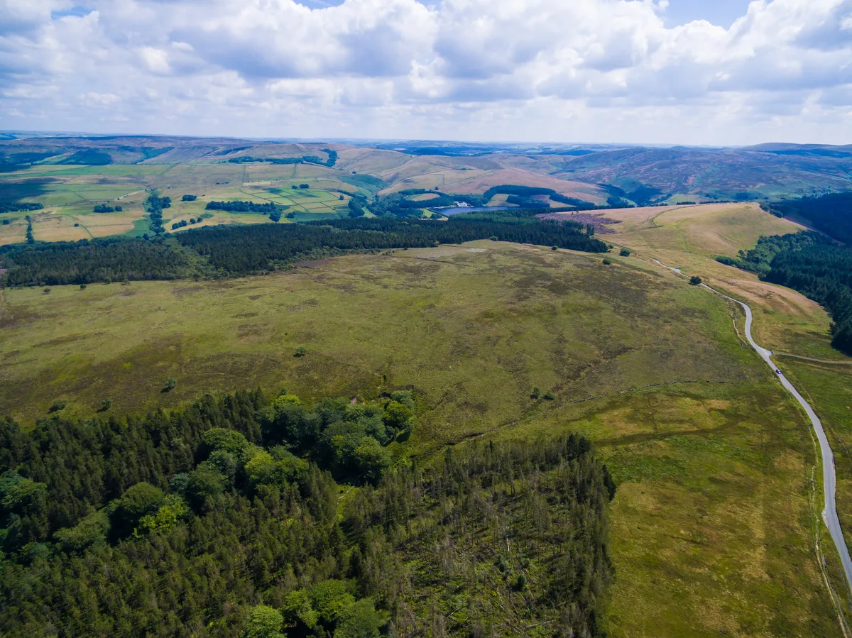
Last updated November 2026: the Peak District National Park covers 555 square miles across Derbyshire, Cheshire, Staffordshire and South Yorkshire. It became Britain's first national park in 1951, and entry is free. Below are seven stops that show both halves of the park, plus a framework for choosing a base and a route.
Featured image: Dave_S., CC BY 2.0, via Flickr.
Peak District National Park at a glance
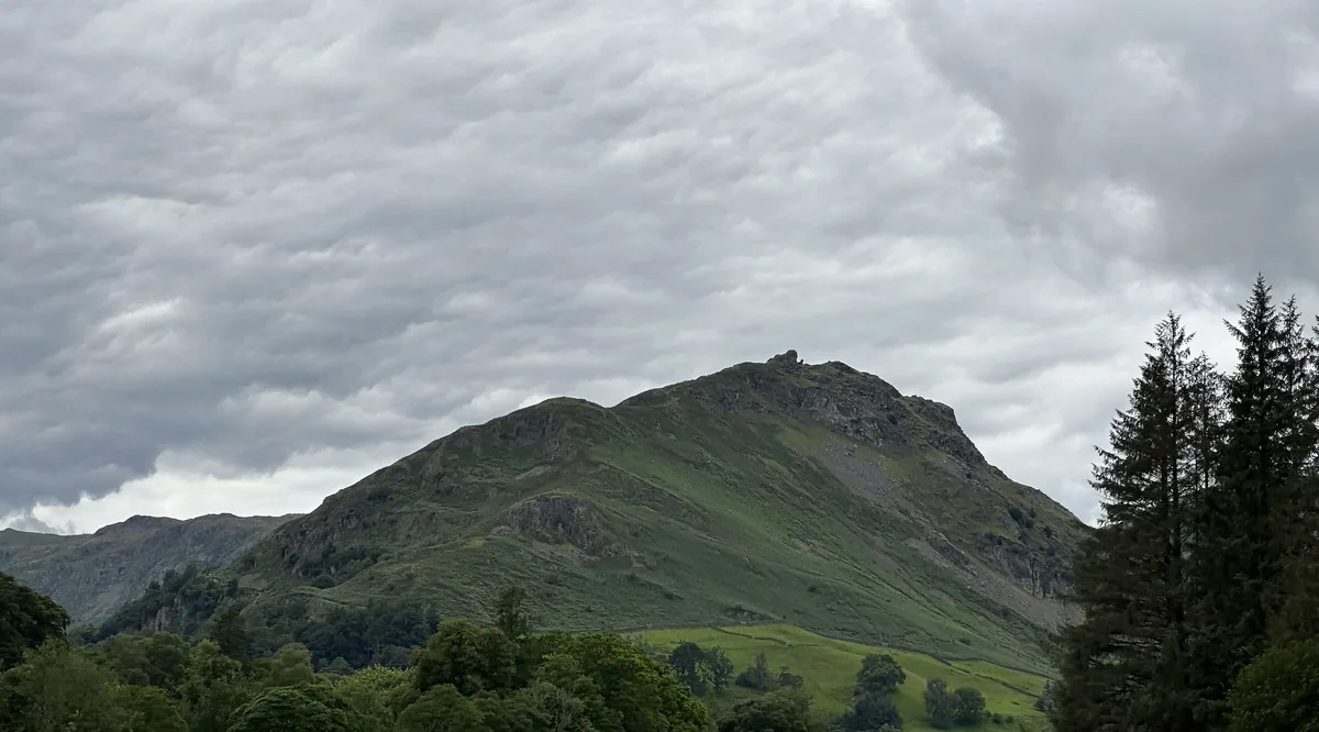
Two landscapes define the park. Dark Peak means gritstone edges and open moorland, with Kinder Scout and Stanage Edge as the headline names. White Peak means limestone dales, caves and market towns such as Bakewell. Sheffield and Manchester are the main gateway cities, roughly 15 and 20 miles from the park. You pay only for attractions, caverns and parking. The official visitor site lists events and seasonal updates. Use this page as the hub, then follow the links to each detailed guide.
The Peak District was the first national park designated in Britain, in 1951. Our overview of national parks in Europe shows where it sits among the continent’s parks.
Dark Peak vs White Peak: which suits you
Pick the half that matches your fitness, your weather tolerance and your transport. Many trips combine both, but the table shows what each demands.
| Dark Peak | White Peak | |
|---|---|---|
| Landscape | Gritstone edges, open moorland, reservoirs | Limestone dales, caves, market towns |
| Best for | Confident walkers, climbers, photographers | Families, cyclists, cave visitors, village stops |
| Typical activities | Kinder Scout and Mam Tor walks, climbing at Stanage and Froggatt Edge, Pennine Way start | Monsal and Tissington trails, Dovedale, show caves, Chatsworth |
| Weather exposure | High, with little shelter on the plateaus | Lower, with sheltered dales and more indoor stops |
| Base towns | Edale, Hathersage | Bakewell, Castleton, Buxton, Ashbourne, Hartington |
| Skip it if | You want flat strolls or indoor backup plans | You want big open-moor views and climbing |
7 Best Things to Do in the Peak District National Park
Each stop below links to a detailed guide where one exists. Prices and hours checked November 2026: this page quotes no fees, so use each operator's site for current figures. For the wider catalogue, browse our complete Peak District activities list.
1. Mam Tor and the Edale valley
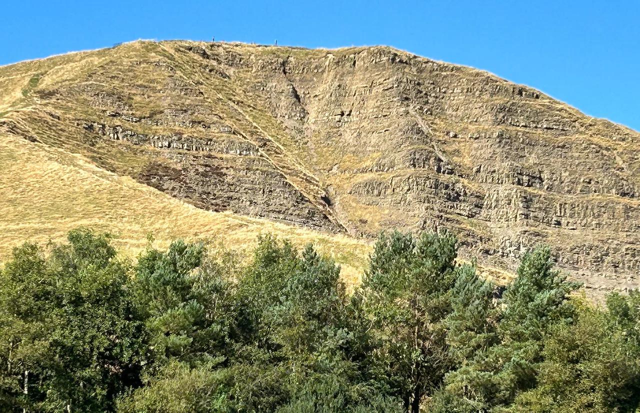
Mam Tor, nicknamed the Shivering Mountain, looks over both the Edale Valley and the Hope Valley. Edale is the start of the 268-mile Pennine Way, which climbs onto Kinder Scout, the park's highest point. Kinder Scout also saw the 1932 mass trespass, a protest that helped secure public access to open country.
Parking is tight around Mam Tor on busy days, so arrive early or take the train to Edale. Skip the Kinder plateau in low cloud unless you can navigate with an OS map and compass.
2. Castleton and its show caves
Castleton is the park's cave village, with Peak Cavern, Speedwell Cavern, Blue John Cavern and Treak Cliff Cavern all running guided tours. Tours mean booking a slot rather than wandering in, so check each operator's site for times. Castleton is one of the park's honeypots for parking, which makes a weekday or early start worth the effort.
Our caves comparison further down sets the four tours side by side. Skip the caves if enclosed, damp spaces put you off, and walk up Mam Tor instead.
3. Chatsworth House
Chatsworth House Visitor Guide: Plan Your Visit is a grand stately home known as the Palace of the Peak, with gardens and art-filled interiors. Events and exhibitions run through the year, and opening times and tickets are listed on the Chatsworth official site. Haddon Hall, a medieval manor house dating to the 12th century, is a smaller alternative and a popular filming location for period dramas.
Like the caves, stately homes are paid attractions, unlike the open moors. Skip Chatsworth if you have a single dry day and want summit views instead.
4. Bakewell and the Monsal Trail
Bakewell is a market town famous for Bakewell pudding, with a weekly market and riverside walks along the River Wye. From Bakewell, the Monsal Trail runs 8.5 miles to Blackwell Mill on a former railway line, through tunnels and over viaducts. Its flat, traffic-free surface suits walkers, cyclists and families.
Monsal Head gives the classic view over Monsal Dale and the Monsal Viaduct. Expect crowds and parking pressure in Bakewell on bank holidays, so start early or skip the town centre then.
5. Stanage Edge
Stanage Edge is a gritstone escarpment and one of the park's best-known photography spots. Sunrise and sunset bring the strongest contrast and shadow along the edge. Climbers of all skill levels use Stanage and nearby Froggatt Edge.
Exposure is high on this open Dark Peak ground, so carry layers and a paper map. Parking comes under pressure on fine weekends, so plan an early arrival. Skip it in strong wind or low cloud if you are not used to exposed edges.
6. Dovedale and the Tissington Trail
Dovedale is a limestone ravine with stepping stones across the River Dove. Autumn colour makes it especially popular with photographers. Parking pressure is a known problem here, so arrive early.
From Ashbourne, the 13-mile Tissington Trail runs to Parsley Hay on another former railway line. Traffic-free walkers, cyclists and horse riders pass Tissington village, known for its well-dressing tradition. Skip the stepping stones when the river looks high.
7. Ladybower and the Derwent reservoirs
Ladybower Reservoir was built for industry and water supply, and its still water reflects the surrounding hills on misty mornings. Wartime dams at Derwent and the Derwent Valley Mills tell a story of national significance. Photographers favour early light here, when mist hangs over the water.
Pair it with a Stanage sunrise if you are staying on the Dark Peak side of the park. Skip it if you want summit views, since this is a quieter, lower-level stop.
Where to base yourself in the Peak District
Choose a base by transport and parking pressure, not only by view. Our village-by-village guide covers the smaller options. Compare Peak District hotel options for a roof and a bath. Look at camping pitches across the park if you prefer a tent.
| Base | Walking access | Public transport | Parking pressure | Best fit |
|---|---|---|---|---|
| Bakewell | Monsal Trail and River Wye walks | Bus links: verify | High at peak times | First-timers and food lovers |
| Castleton | Mam Tor and the show caves | Train to Hope, onward link: verify | High | Cave fans and walkers |
| Edale | Pennine Way start, Kinder Scout | Train station | Not rated | Serious walkers without a car |
| Hathersage | Edges and moorland routes | Train station | Not rated | Climbers and Dark Peak walkers |
| Buxton | Spa town; Opera House on site | Train station | Not rated | Culture and car-free trips |
| Matlock / Matlock Bath | Riverside and hill walks | Train stations at both | Not rated | Car-free short breaks |
| Ashbourne | Tissington Trail start | Bus links: verify | Not rated | Cyclists |
| Hartington / Tideswell | Dales and Limestone Way routes | Not rated | Lower, verify | Quiet stays by car |
How many days you need
Fewer days mean choosing one half of the park. Do not try to cover both on a single day.
- 1 day: pick Castleton with a Mam Tor walk and one cave tour, or Bakewell with the 8.5-mile Monsal Trail. Skip Chatsworth and the Dark Peak edges.
- 2–3 days: pair a Castleton and Edale day with a Bakewell and Chatsworth day. Add Dovedale if you are driving.
- 4+ days: add Stanage Edge, Ladybower, the 13-mile Tissington Trail and a Buxton or Matlock Bath stop. Check driving times between bases before you book.
Getting to the Peak District and getting around
Sheffield and Manchester are the main gateway cities, roughly 15 and 20 miles from the park. Trains stop at Edale, Hope and Hathersage. Buxton, Matlock and Matlock Bath also have stations. Check National Rail for current Hope Valley line services and operators. By car, parking runs short at Castleton, Mam Tor, Stanage, Dovedale and Bakewell at peak times. Read the park authority's parking guidance before you set off. Our map of towns, caves and trails helps you plan a route. Booking car-free guided tour options removes the parking question.
Costs: what is free and what you pay for
Entry to the park is free, but Chatsworth, the caverns and car parks all charge. Check current prices on the operators' own sites.
Best time to visit the Peak District
Late spring (May–June) and early autumn (September–October) are the usual picks. Dovedale colours up in autumn. Bank holidays bring crowds and fuller car parks. Winter, including late November, means short daylight and exposed moorland. Plan low-level routes then and start early. Read our month-by-month weather guide and check the Met Office forecast before you climb.
Peak District caves compared
Four show caves cluster around Castleton. Our Peak Cavern guide covers that tour in depth. Speedwell Cavern's underground boat tour has its own page. See Blue John Cavern's guided route for the third. Treak Cliff Cavern has no guide here yet. Operators publish tour details on the Peak Cavern and Speedwell Cavern sites.
| Cave | Format | Plan around |
|---|---|---|
| Peak Cavern | Guided tour | Step and walking access: ask the operator |
| Speedwell Cavern | Guided tour with a boat section | Access limits and booking: ask the operator |
| Blue John Cavern | Guided tour | Steps and walking distance: ask the operator |
| Treak Cliff Cavern | Guided tour | Booking: ask the operator |
Best walks, trails and photography stops
Trail lengths below are the commonly listed figures. Measure your own route on an OS map.
| Trail | Length | Traffic-free | Difficulty | Best fit |
|---|---|---|---|---|
| Monsal Trail | 8.5 miles, Bakewell to Blackwell Mill | Yes | Easy, flat | Families, cyclists |
| Tissington Trail | 13 miles, Ashbourne to Parsley Hay | Yes | Easy | Walkers, cyclists, horse riders |
| High Peak Trail | 17 miles, High Peak Junction to Dowlow | Yes | Gentle gradients with steeper inclines | Cyclists, industrial-heritage fans |
| Limestone Way | 46 miles, Castleton to Rocester | No | Moderate | Village-to-village walkers |
| Pennine Way (start) | 268 miles in total, from Edale | No | Challenging | Experienced long-distance walkers |
- Stanage: sunrise and sunset give the strongest light. Expect an exposed edge.
- Winnats Pass: a narrow limestone gorge that photographs best at dawn or dusk.
- Ladybower: misty mornings add reflections on the water.
- Monsal Head: sunrise and sunset suit the viaduct view.
- Dovedale: autumn colour is the draw, with stepping stones as the foreground.
Safety and countryside practicalities
Carry OS Explorer maps for moorland, because paths fade and cloud drops fast. Pick weather windows and turn back if visibility closes in. Follow the Countryside Code on access land, and keep dogs on a short lead around livestock. In an emergency, call 999 and ask for the police, then Mountain Rescue. Book cave tours through the operators rather than turning up.
Low cloud on Kinder plateau suits only confident navigators with an OS map and compass. In trouble, call 999 and ask for the police, then Mountain Rescue.
Common mistakes to avoid
These are the errors that cost visitors the most time.
- Driving to Castleton or Mam Tor at midday on a bank holiday.
- Heading onto Kinder Scout without a map or a weather check.
- Packing for valley weather and meeting moorland wind.
- Treating Alton Towers as part of the park. It sits nearby, not in the park, and Heights of Abraham boundary status is worth verifying.
- Planning long days in winter without allowing for short daylight.
Frequently Asked Questions
Does the UK have national parks?
Yes. The Peak District became the UK's first national park in 1951.
What is the famous pass in the Peak District?
Winnats Pass is the best-known. It is a narrow limestone gorge with a steep, winding road. Low light at dawn or dusk shows off its texture.
Explore More Guides
Keep planning your trip with these guides.
Guides
- Chatsworth House Visitor Guide
- Castleton, Peak District
- Bakewell, Derbyshire
- Blue John Cavern: Tickets, Tour, Steps and How to Visit
- Peak District Map: Areas, Which Map to Use & Getting Around
- Peak Cavern Castleton
- Peak District Weather: Seasons, Forecasts and What to Pack
- 8 Best Things to Do in Peak District
- Speedwell Cavern Castleton
- Hotels in the Peak District
- Peak District Camping: Campsites, Wild Camping Rules and Bases
- Peak District Tours: Guided, Day Trip and DIY Options Compared
- Peak District Villages: Best Ones to Visit and How to Choose
Notes for your next park visit
Optional updates to our national park guides.
Read next
Keep planning
Picked from the same area