
7 Best Things to Do at Thingvellir National Park
Plan Thingvellir National Park: 7 things to do, how long to allow, Silfra, parking, seasons and whether to self-drive or take a tour.
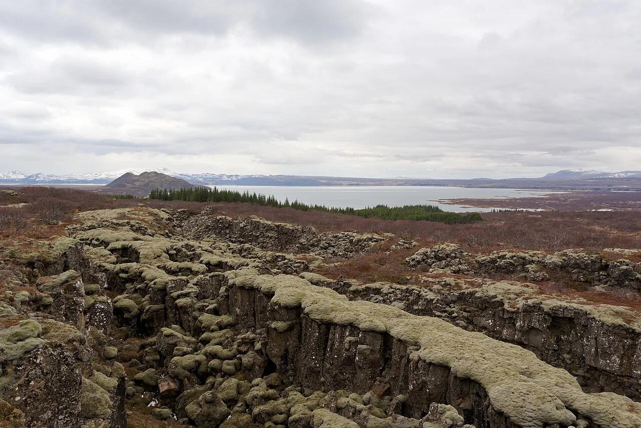
Last updated November 2026: Thingvellir National Park is a UNESCO World Heritage site about 40 km (25 miles) from Reykjavík, roughly a 45-minute drive. Þingvellir suits anyone who wants rift cliffs, the site of Iceland's early parliament and a Golden Circle first stop in one walkable landscape. We'd give it at least half a day rather than a 20-minute photo stop.
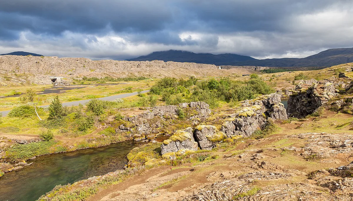
Featured image: Jakub Hałun, CC BY-SA 4.0, via Wikimedia Commons.
Thingvellir National Park at a glance
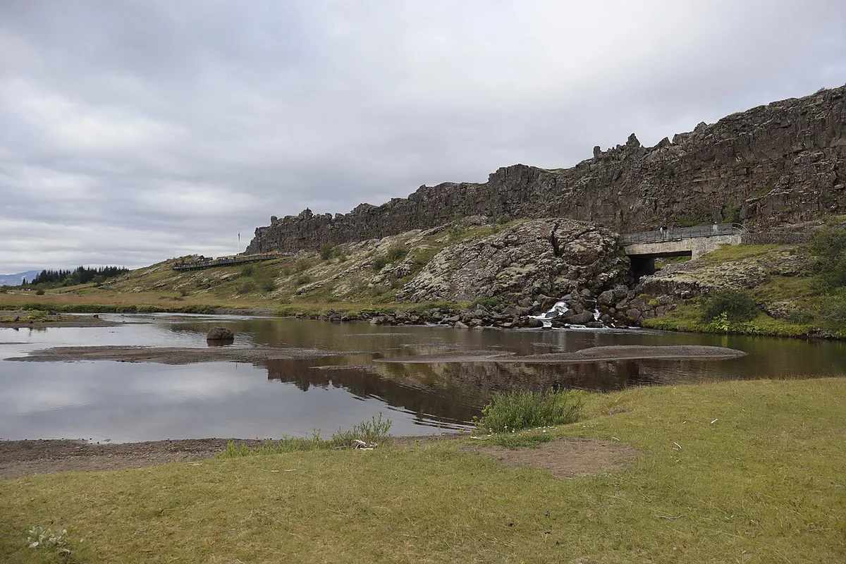
Thingvellir National Park lies in south-west Iceland, in a rift valley where the North American and Eurasian plates pull apart. Most visitors reach it as the first stop on the Golden Circle route, ahead of Geysir and Gullfoss. Official hours, fees and rules sit on the park's own website. Þingvallavatn, Iceland's largest natural lake, forms the park's southern and eastern setting. Use the table below for the numbers that shape most plans.
| Feature | Detail |
|---|---|
| Distance from Reykjavík | About 40 km (25 miles) |
| Drive time | About 45 minutes |
| UNESCO listing | Inscribed in 2004 |
| Alþingi founded | Around 930 AD |
| Entry | Walking in is free; parking rules and fees are on thingvellir.is |
| Best months | June to August, highs of about 14 to 16 °C (57 to 61 °F) |
| Time needed | Half a day for the core walk (our estimate) |
7 Best Things to Do at Thingvellir National Park
Prices and hours checked November 2026. We quote no fees in this list, because the official site holds the current rates. Every time below is our own planning estimate, not an official figure. The order follows the classic route from the high viewpoint down to the lake.
1. Almannagjá gorge walk
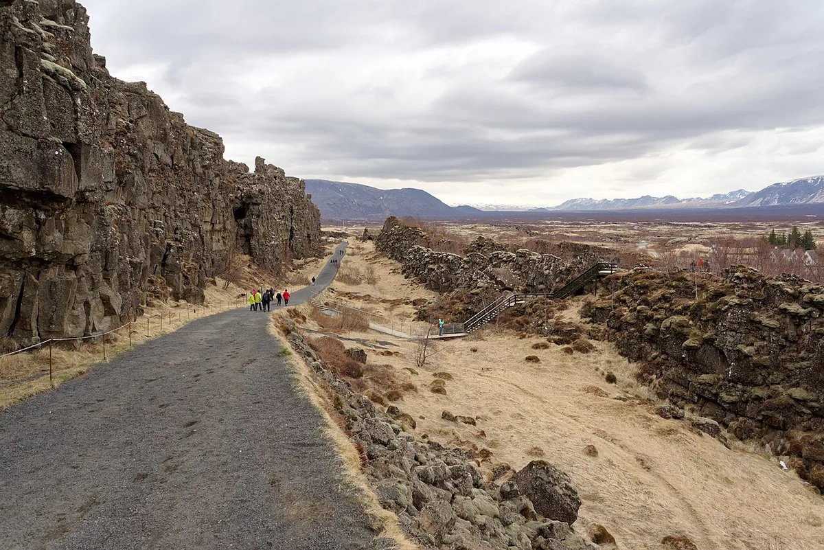
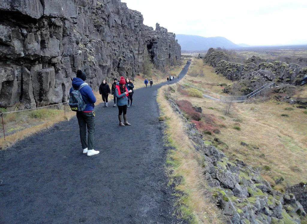
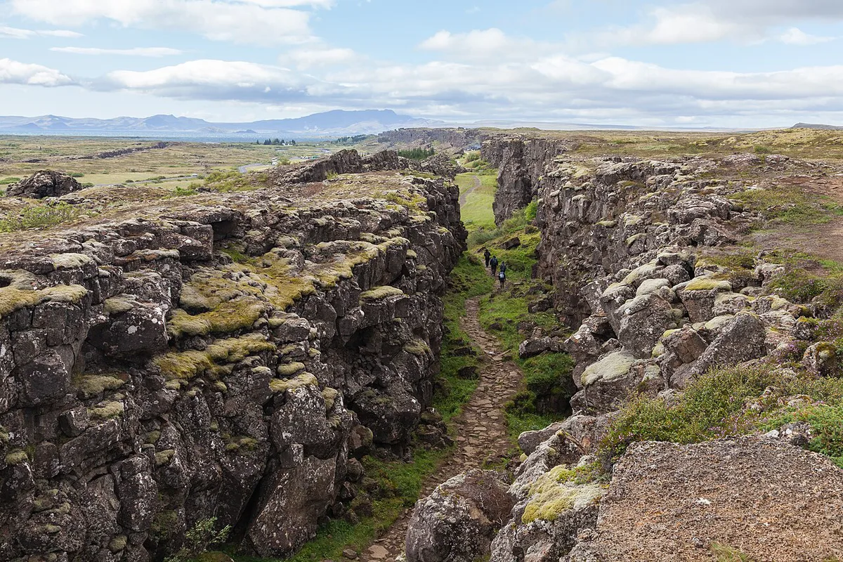
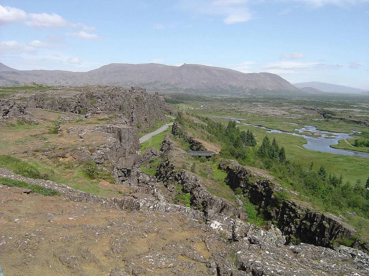
Almannagjá is the park's defining tectonic gorge, and we'd start here on a first visit. A marked path leads down from the Hakið viewpoint towards the assembly plain, so the walk runs downhill beside the cliff wall. Fractured lava and rock faces show how the crust is slowly pulling apart, and the wall exposes the edge of the North American plate.
Budget roughly 30 to 45 minutes one way at an easy pace. Our Almannagjá gorge walk guide covers the route in more detail. Anyone who cannot manage uneven ground may prefer the viewpoint alone, and winter ice is a good reason to turn back.
2. Lögberg and the assembly plain
Lögberg, the Law Rock, marks the traditional spot where laws were proclaimed to the assembly. The plain around it hosted the Alþingi from around 930 AD, and traces of turf-and-stone booths can still be read on the ground. We'd linger here longer than most visitors do, because the broad, open plain explains why communities from across Iceland could gather in one place.
Give it roughly 20 to 30 minutes of slow walking and reading. History readers get the most from this stop. If you only want dramatic scenery, skim past it, since the plain is open ground rather than a viewpoint.
3. Öxarárfoss
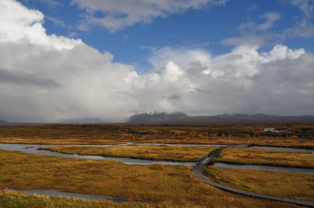
Öxarárfoss is a modest but important waterfall where the Öxará river spills into the gorge. That river crosses the historic assembly area before it reaches the falls. A short walk along the same route as Almannagjá gets you there, so it adds little to a half-day plan.
Set aside about 15 to 20 minutes for the detour. Our Öxarárfoss waterfall guide covers the approach. Visitors without grippy footwear should skip it on icy days.
4. Þingvellir church and farm
Þingvellir church and the adjacent historic farm form a small architectural focus in an otherwise open landscape. Walkers meet them along the route from the assembly site. Keep voices low here, since the church sits inside a protected cultural landscape.
The Þingvellir church page covers the building itself. Fifteen minutes is enough for most people. Best for quiet photography; cut it first when you have only one hour.
5. Hakið viewpoint and visitor centre
Hakið is where most visitors begin, above the Almannagjá gorge. Its visitor centre has toilets, maps and brochures, plus a café. Pick up a map here and look down the gorge before you descend.
Walking down means planning your return to the car, which is why your choice of car park matters. Plan 20 to 30 minutes for the viewpoint and facilities. Skip the café if you have packed food, but do not skip the toilets.
6. Silfra snorkelling or diving
Silfra is a water-filled fissure in the rift, fed by glacial meltwater filtered through porous lava rock. Water stays around 2 to 4 °C (36 to 39 °F) all year, and visibility often exceeds 100 m. Dry suits are required, and sessions usually last around 30 to 40 minutes.
Silfra is guided only and separate from the walking route, so book ahead and never plan it on the spot. Operators set prices and entry rules, so read them on the operator's own page; our Silfra snorkelling guide explains the choices. Skip it if cold water worries you, and walk the gorge instead.
7. Þingvallavatn shoreline and short walks
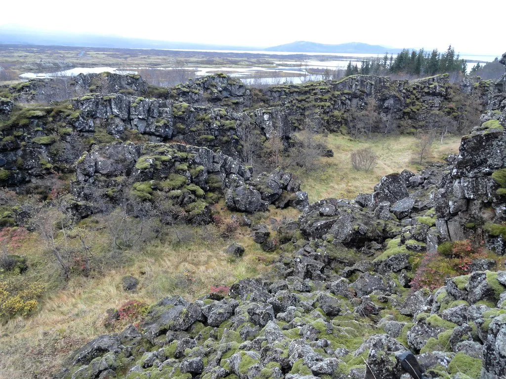
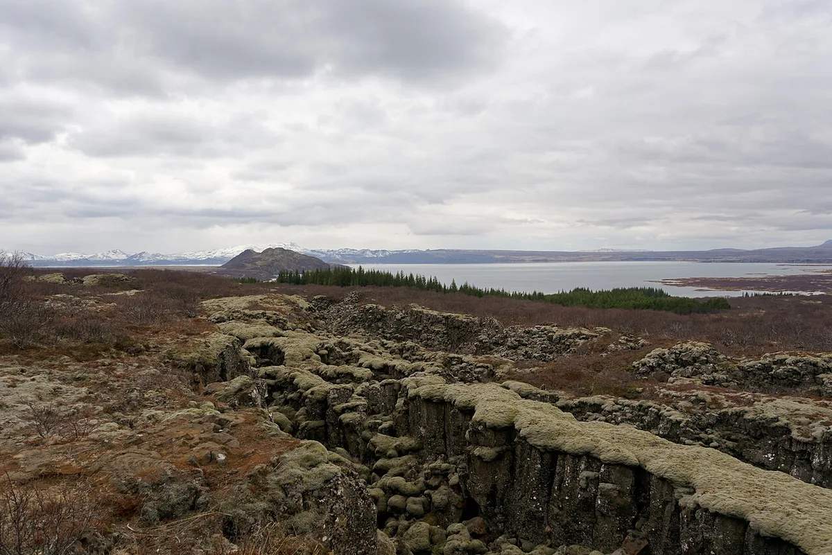
Þingvallavatn is Iceland's largest natural lake, with lava shores and open views towards volcanic hills. Other paths cross mossy lava fields, low woodland and open ground beyond the main historic route. Trout and Arctic char live in the lake, and fishing is popular, but rules apply, so read the park's fishing rules before you cast.
We'd save these paths for a half-day or longer visit, when the main walk is already done. Mud and uneven ground can slow progress outside the marked core, so wear sturdy boots. Visitors with only an hour should skip this item entirely.
How long to spend at Thingvellir and how to plan your time
Þingvellir rewards a plan more than most Golden Circle stops. Start with the park map and pick one of the three lengths below. Each is approximate, so adjust for weather and daylight. Starting at Hakið means a downhill walk through Almannagjá, then a return to the car or a second car park. A lower start avoids the descent but means climbing back for the view. We prefer Hakið first whenever the path is free of ice.
| Plan | Route | What to cut |
|---|---|---|
| 1 hour | Hakið viewpoint, then the Almannagjá descent to Lögberg | Silfra, church farm, lakeshore paths |
| Half day (about 3 to 4 hours) | Add Öxarárfoss, the church and the visitor centre | Silfra, unless you booked it ahead |
| Golden Circle day (roughly 9 to 10 hours on a guided day) | Þingvellir, then Geysir and Gullfoss | Lakeshore walks; Silfra is a separate booking |
A short history of the Alþingi and why it earned UNESCO status
Iceland's national assembly, the Alþingi, was founded at Þingvellir around 930 AD. Each summer, chieftains, farmers and other participants travelled here for law-making, legal disputes and trading. The assembly continued to meet at the site until 1798. UNESCO inscribed Þingvellir on the World Heritage List in 2004 for this combination of cultural and natural significance. It was not a modern democracy, since authority sat with chieftains, but it gave early Icelandic society a formal framework. That is why the site remains central to national memory.
Þingvellir became a national park in 1930, which makes it one of the older protected areas on the continent; our overview of national parks in Europe shows how it compares with parks elsewhere.
Standing on the plate boundary: what you see and what you don't
The park sits in a rift valley on the Mid-Atlantic Ridge, where the North American and Eurasian plates are slowly separating. Reported drift is roughly 2 centimeters (under an inch) per year. Almannagjá, with its walls of fractured lava, is the clearest place to read that story. Be careful with the popular "one foot in each continent" line. The rift is a zone of fissures and subsidence rather than a single line, so walking through it does not mean standing on both plates. Stay behind barriers, because fissure edges are steep and uneven.
Costs, parking and opening hours
Walking the park is free, but we cannot quote a parking fee we have not seen published. Read current rates, car park layout and opening times on the official Þingvellir site, and see our parking options at Þingvellir page for the trade-offs.
Getting there: self-drive vs Golden Circle tour
Self-driving gives control, and a tour removes road risk. Our Golden Circle tour from Reykjavík guide compares day trips. Browse guided Þingvellir tour options if you prefer a driver. Public transport to individual park sites is limited, so bus travel needs careful planning. Before any winter drive, read current road conditions and allow extra time for the drive back to Reykjavík.
Pairing Thingvellir with Geysir and Gullfoss can run 9 to 10 hours on a guided day, far beyond the half-day Thingvellir block.
| Factor | Self-drive | Guided tour |
|---|---|---|
| Cost | Cheaper for groups sharing a car, plus parking | Pricier per person, with transport included |
| Time pressure | Set your own pace and stay longer in Almannagjá | Fixed stop lengths on a multi-stop day |
| Winter driving | You handle ice and weather | Driver handles conditions |
| Silfra | Book a separate guided session | Usually a separate booking too |
| Hakið vs lower area | You choose where to start | Operator chooses the stop |
Best time to visit Thingvellir: season by season
Monthly averages below are approximate. June to August is warmest, with highs of 14 to 16 °C (57 to 61 °F) and about 30 mm of rain a month. December and January run colder, at highs near 3 °C (37 °F) and about 60 mm. Winter paths can be icy and daylight is short, so pack traction footwear, layers and a start-early plan. Check the Icelandic Met Office forecast before you leave. Our weather conditions at the park guide goes month by month.
| Season | Typical highs | Planning note |
|---|---|---|
| Winter (Nov to Mar) | 3 to 4 °C (37 to 39 °F) | Icy paths and short daylight; allow extra time |
| Spring (Apr to May) | 6 to 10 °C (43 to 50 °F) | Mud and uneven ground |
| Summer (Jun to Aug) | 14 to 16 °C (57 to 61 °F) | Long daylight and the most time to explore |
| Autumn (Sep to Oct) | 7 to 12 °C (45 to 54 °F) | Cooler, with quieter edges of the day |
Where to eat, stay and base yourself
Food inside the park is limited, with refreshments concentrated around the visitor facilities. Pack lunch and water, and check café hours outside summer. Laugarvatn is a practical Golden Circle base, with Lindin restaurant and a Samkaup strax grocery. Selfoss is the larger regional service centre, and Reykjavík has the widest choice. There is no nightlife, shopping district or bar scene inside the park, and evenings are quiet. For overnight options, see places to stay nearby. Tent and camper travellers can read about campsite options before booking.
Mistakes to avoid at Thingvellir
Most problems here come from underplanning, not from the landscape itself.
- Treating it as a 20-minute photo stop and missing the walk below Hakið.
- Arriving without winter-ready footwear when paths can be icy.
- Assuming Silfra can be done on the spot instead of booking a guided session.
- Forgetting the walk back or the shuttle logistics after a downhill start.
- Underestimating the drive back to Reykjavík, roughly 45 minutes in good conditions.
Frequently Asked Questions
How do you pronounce Thingvellir National Park?
The Icelandic letter Þ sounds like the "th" in "thing". Say it roughly as THING-vet-lir.
Explore More Guides
Keep planning your trip with these guides.
Guides
- Golden Circle Iceland: Route, Time and Season Tips
- Golden Circle Tour From Reykjavik: Which Option Fits You
- Silfra Fissure: Snorkel or Dive Between Tectonic Plates
- Öxarárfoss (Oxararfoss) Waterfall
- Thingvellir Visitor Center: Location, Hours & Is It Worth a Stop
- Thingvellir Tours: Golden Circle, Silfra or Self-Drive?
- Walk Iceland's Rift Between Plates
- Thingvellir Map: Park Layout, Sights & Parking
- Thingvellir Camping: Campsite, Rules, Season & Tips
- Thingvellir Parking: Lots, Fees & Which to Use
- Thingvellir Weather: What to Expect by Season and How to Plan
- Thingvellir Church (Þingvallakirkja)
- Hotels Near Thingvellir: Where to Stay (Honest Guide)
Notes for your next park visit
Optional updates to our national park guides.
Read next

Keep planning
Picked from the same area