
Cilento National Park Guide: Caves, Coves, Trails & Where to Stay
Plan Cilento National Park: car vs bus, where to base yourself, caves, beaches, trails, costs and the best months in 2026 for Paestum to Palinuro.
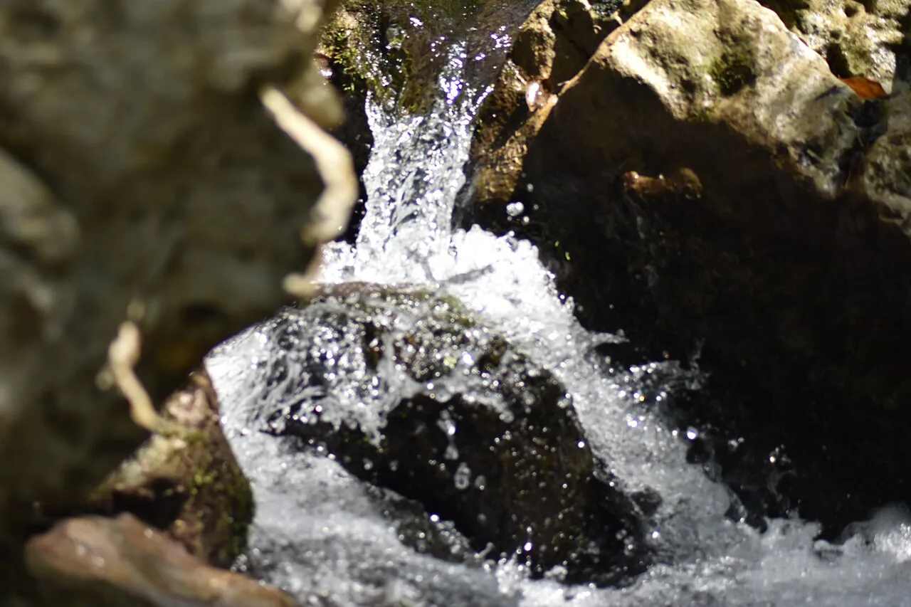
Last updated November 2026: Cilento National Park, officially Cilento, Vallo di Diano and Alburni National Park, is a UNESCO-listed park in Campania, south of Salerno. Sea caves, a Greek temple site at Paestum and mountain trails on Monte Cervati share one protected area, so your main decision is car versus public transport. Three to six days suits the park well, while a long weekend only samples one corner. For the wider picture, start with our guide to Italy's national park network.
Featured image: Alessandro Cossu, CC BY-SA 4.0, via Wikimedia Commons.
Cilento National Park at a glance
Established in 1991, the park covers 181,048 hectares, from the Tyrrhenian coast to the foothills of the Campania-Lucanian Apennines. UNESCO listed it as a World Heritage Site in 1998. Paestum, Velia and the Certosa di Padula sit inside the listed area. Trail notices, marine-area rules and visitor information live on the park authority's official site. Verdict: rent a car for villages and trailheads, because settlements sit on ridgelines and many inland buses skip Sundays.
| Quick fact | Detail |
|---|---|
| Location | Campania, south of Salerno |
| Status | National park and UNESCO World Heritage Site (1998) |
| Best months | May, June and September; March to June and September to November also work well |
| Transport verdict | Car for inland and trailheads; train and bus are workable on the coast |
| Suggested stay | 3 to 6 days |
Is Cilento worth it? Who it suits and who should skip it
Cilento rewards travelers who like to mix a Greek ruin, an underground river and a swim in one trip. Hikers get beech forest on Monte Cervati, and beach people get coves that road traffic cannot reach. Skip it if you want a single-day excursion from Naples, because the distances between sights are real. Skip it as well if you plan a mid-August beach week and hate crowds. Travelers comparing destinations can weigh it against the options in our ranking of Italy's best parks.
Best things to do in Cilento National Park
Prices and hours checked November 2026. Each cave sells its own ticket, at roughly €15 to 25. Park trails and villages carry no general entrance fee.
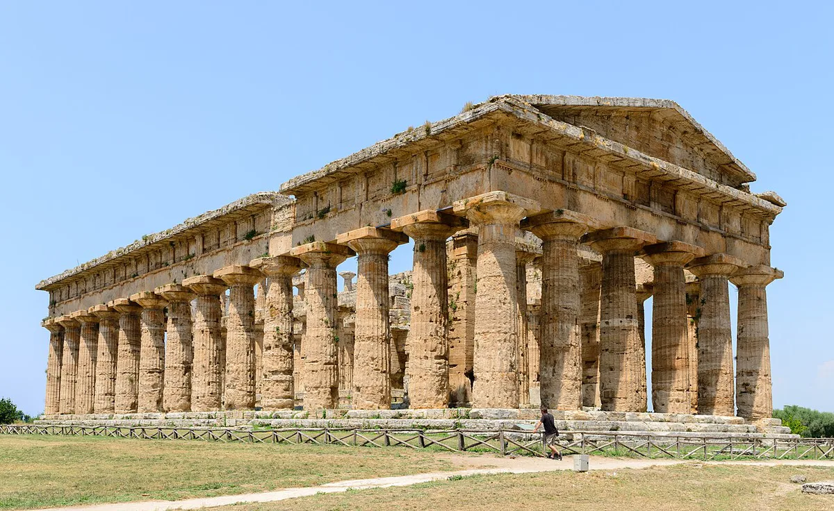
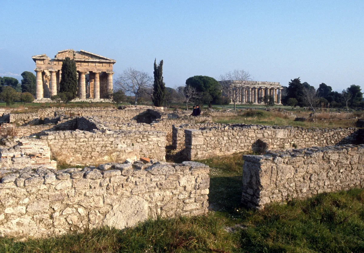
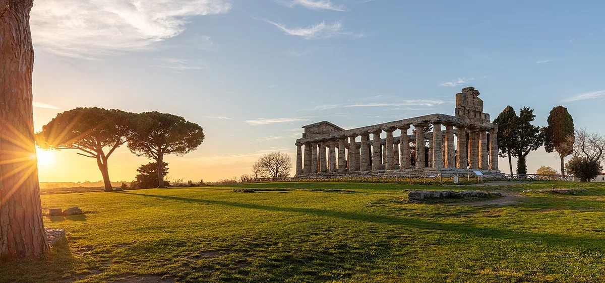
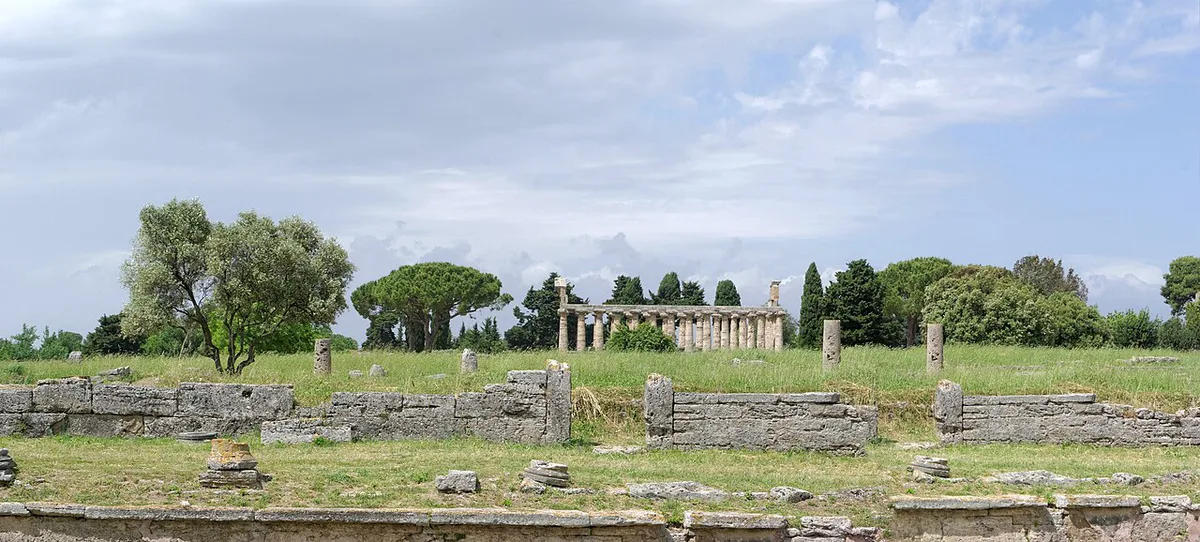
- Paestum temples: three well-preserved Doric temples from the Greek colony of Poseidonia, standing in open fields on the park's northern edge. Entry runs about €15 including the museum.
- Pertosa-Auletta caves: a short boat ride on an underground river, then a walk through chambers of stalactites. Allow about 1 hour.
- Castelcivita caves: a long guided route through limestone halls with a steady cool temperature year-round. Allow about 90 minutes.
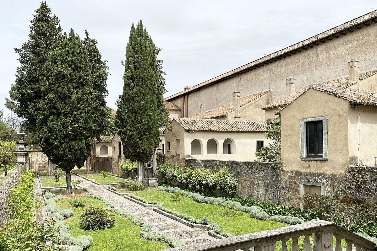
- Certosa di Padula: one of Italy's largest monastic complexes, in the Vallo di Diano, with huge cloisters and a spiral staircase. Count on about 2 hours.
- Velia: an ancient Greek city inside the UNESCO-listed area, which pairs well with a coastal day.
- Monte Cervati: the highest summit in the park at about 1,900 m, with beech woods, open pastures and views toward both coasts on a clear day.
- Infreschi coast and Punta Licosa: cliffs, pebbly coves and a rocky headland, covered in the next section.
Beaches and the protected marine areas
Cilento's coast is indented, with sea caves and small bays, and access method matters more than beach name. Buondormire beach near Palinuro is reachable only by sea. Baia degli Infreschi lies between Marina di Camerota and Scario, with pebbles mixed with sand and deep water. You reach it by boat or a long coastal walk. Punta Licosa, near Castellabate, sits inside a marine protected area. Palinuro and Marina di Camerota have easier road access, and both fill with Italian families in July and August. The park protects two marine zones: Costa degli Infreschi e della Masseta, and Santa Maria di Castellabate around Punta Licosa. Posidonia meadows, groupers and moray eels live in both. Regulations on anchoring, diving and landing differ by zone, so read the rules on the park authority's visitor pages before booking a boat.
- Buondormire: boat only, near Palinuro.
- Infreschi: boat or long coastal walk from Marina di Camerota.
- Punta Licosa: headland walk or swim, near Castellabate.
- Palinuro and Marina di Camerota: road access, sea caves, busiest in summer.
Hiking in Cilento National Park: trails by difficulty and time
Trails here cross rocky limestone, forest tracks and old mule paths. Monte Cervati is the big day, with a climb of about 800 m through beech forest and open meadow. Coastal paths are shorter, but exposed and hot. Route lengths and trail status change, so check them with the park authority or CAI before you set out. Know when the last return bus leaves before committing to a trailhead.
Monte Cervati's 6 to 8 hours round trip means carrying 2 to 3 liters of water, so starting at dawn is sensible.
| Trail | Difficulty | Time or length | Best fit |
|---|---|---|---|
| Monte Cervati summit | Moderate to hard | 6 to 8 hours round trip, about 800 m climb, from near Sanza | Fit hikers with a car |
| Infreschi coastal path | Moderate, exposed | 4 to 5 hours one way from Marina di Camerota | Swimmers who carry plenty of water |
| Sentiero del Castelluccio | Moderate | 10 km with a 500 m vertical drop | Viewpoint seekers: Marina di Pisciotta and Capo Palinuro |
| Lovers' Path | Easy | 2 km, 140 m altitude difference | Families and short outings |
| Punta Licosa walk | Easy | Loop of about 2 hours near Castellabate | Sea views without a long day |
| Magliano Nuovo to Postiglione | Long | 30 km through the Gole del Calore, past a medieval bridge | Multi-day or experienced walkers |
How to get around: car, bus and train trade-offs
Trains on the Tyrrhenian line serve Agropoli, Pisciotta and Sapri, and Naples to those stops takes roughly 1.5 to 3 hours. Agropoli is the practical gateway, with buses to Paestum and the interior. Regional buses also link Vallo della Lucania and coastal towns. Inland villages such as Sanza and Roscigno see few services, and many buses do not run on Sundays. A rental car costs about €35 to 60 a day in 2026.
| Trip style | Transport it needs | Catch |
|---|---|---|
| Coast only | Train to Agropoli, then regional buses | Sparse off-season and Sunday service |
| Caves and temples | Car, or tight bus planning | Caves and Certosa sit far apart |
| Hiking | Car | Trailheads near villages like Sanza have few buses |
Where to stay: choosing a base
The park has no hotels in its core, only a few mountain huts and rural farm stays. Pick a coastal town or an inland village based on your main activity. Book ahead for August and the Ferragosto weekend in mid-August. Outside summer, walk-in rates are often negotiable.
| Base | Best for | Access | Season caveat |
|---|---|---|---|
| Agropoli | First-timers and rail travelers | Train station, buses to Paestum and the interior | Quieter out of season |
| Palinuro | Sea caves, boat trips, campsites | Road and regional bus | Packed in July and August |
| Marina di Camerota | Infreschi access, budget rooms | Road and regional bus | Packed in July and August |
| Pioppi and Acciaroli | Quiet family stays | Road | Seasonal hotels cut back in winter |
| Sanza, Sassano, Padula | Hikers and culture | Car strongly advised | Agriturismi often cheaper than the coast outside summer |
Best time to visit Cilento, month by month
Climate averages shape the choice. Spring brings highs of 17 to 26°C (63 to 79°F), wildflowers on Monte Cervati and quiet trails outside Easter and the June 2 holiday weekend. Summer coasts reach 29 to 33°C (84 to 91°F), and inland trails run hot below 1,000 m. Autumn sea temperatures hold near 22 to 25°C (72 to 77°F), with air at 20 to 27°C (68 to 81°F) and chestnut and mushroom season starting. Winter highs of 11 to 15°C (52 to 59°F) come with snow on high peaks, short daylight and reduced hotel and bus service. May, June and September balance warm weather, open lodging and prices below the August peak.
How many days do you need in Cilento?
Each plan below follows geography, so no day involves a long backtrack. Drive times are not quoted here; a map app gives them for your route.
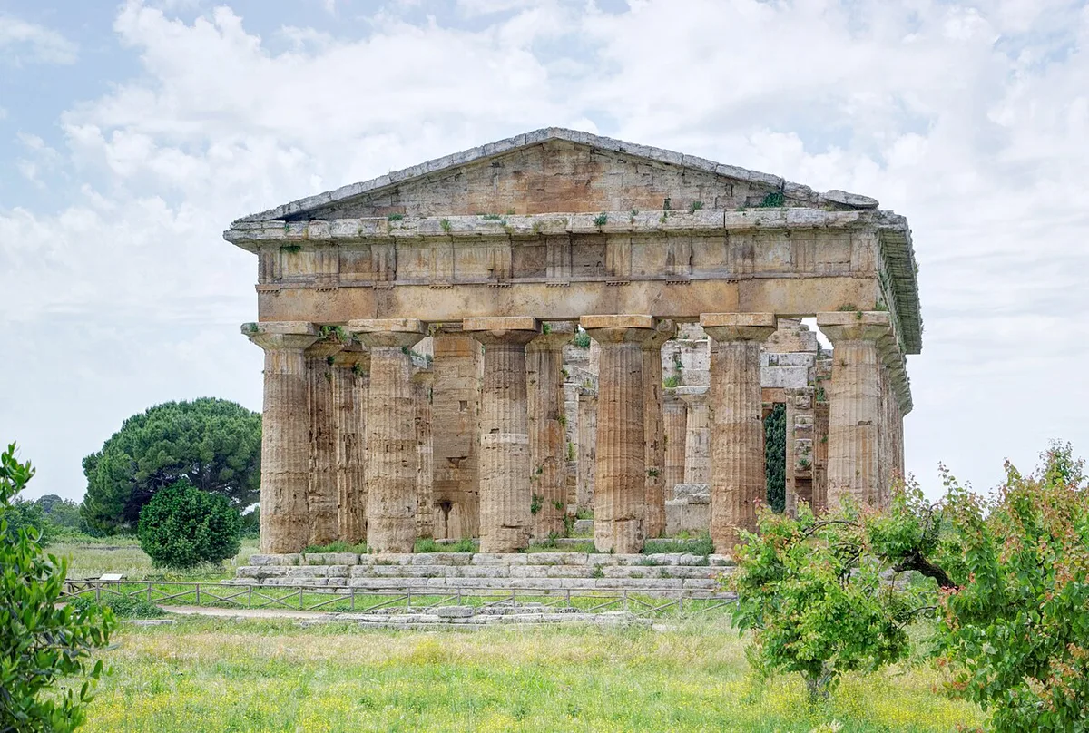
- 1 day: Paestum temples in the morning, then lunch in Agropoli. Add Velia only if time allows.
- Long weekend: Day 1 at Paestum and Agropoli. Day 2 for the Pertosa-Auletta or Castelcivita caves and the Certosa di Padula. Day 3 on the Palinuro or Marina di Camerota coast.
- 5 to 6 days: two days around Palinuro and Marina di Camerota, one at Paestum or Padula, and one or two for Monte Cervati or the Alburni. Spend the last day at Punta Licosa or Acciaroli.
Costs and tickets in Cilento National Park
Reported 2026 budgets run €60 to 85 a day for a backpacker in high season, excluding car rental. Spring and autumn lodging is reported 20 to 40 percent lower. Dinner of pizza or pasta runs about €8 to 12. Prices and hours checked November 2026.
| Item | Reported range |
|---|---|
| Park entry | €0 for trails and villages |
| Cave tickets (each) | About €15 to 25 |
| Paestum with museum | About €15 |
| Accommodation, high season | €30 to 50 |
| Accommodation, low season | €20 to 35 |
| Local transport | €5 to 15 a day |
| Food and supplies | €15 to 25 a day |
| Car rental | About €35 to 60 a day |
Mediterranean diet and local food
Pioppi, Acciaroli and Pollica are the villages tied to the Mediterranean diet story. Ancel Keys conducted his studies on the diet in this area. UNESCO recognizes the Mediterranean diet as a tradition of growing, fishing, preserving and sharing food. Menus lean on buffalo mozzarella, fig preserves, olive oil and fresh fish. Fish costs more than pasta, so budget accordingly.
Safety and practical tips
Most problems come from heat, patchy signage and sparse transport. On July and August trails, temperatures can pass 30°C (86°F), so carry 2 to 3 liters of water and start at dawn. Download an offline map, since mobile signal fails in valleys. Limestone gets slick after rain. Sea currents run strong near caves and capes, so swim near lifeguards when possible. Conditions change, so check with the park authority before hard routes.
- Check the last return bus before committing to a trailhead.
- Avoid summer midday on inland trails.
- Do not assume every cove has road access.
- Treat the park as a multi-day trip, not a day trip from Naples.
Other Italian national parks to combine or compare
Southern Italy offers several parks for a longer trip. Vesuvius, the closest Campania park, makes an easy add-on near Naples. Pollino is reported about 75 km away, and our guide to the Pollino massif covers it. Travelers heading further south can look at the Sila park. Another option is the Aspromonte park.
Notes for your next park visit
Optional updates to our national park guides.
Read next

Keep planning
Picked from the same area