
Mols Bjerge National Park: Hikes, Access & Trip Planning
Plan a visit to Mols Bjerge National Park in Denmark: free access, the 80 km trail, short walks, Kalø Castle, how to get there and when to go.
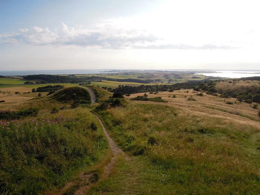
Last updated November 2026: Mols Bjerge National Park (Nationalpark Mols Bjerge) covers about 180 km² of Ice Age hills, heath and coast on Denmark's Djursland peninsula. Entry is free, the park is open year-round, and its headline route is the 80 km Mols Bjerge Trail. It belongs to Denmark's national park network, and this guide helps you decide how much time to give it.
Featured image: David~, CC BY 2.0, via Flickr.
Mols Bjerge National Park at a glance
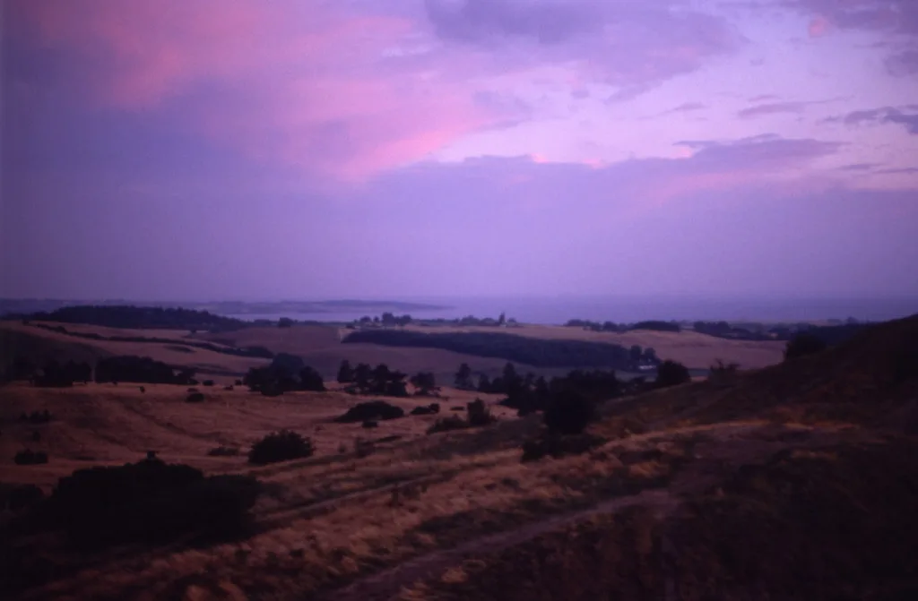
Mols Bjerge sits in Syddjurs Municipality, with Ebeltoft as its nearest town. Queen Margrethe II inaugurated the park on 29 August 2009. Roughly 180 km² of rolling terrain left by the last ice age falls inside it. Core of the park is the Mols Hills, which cover about 2,500 ha and peak at 137 m. Expect gentle Ice Age relief rather than mountains. Per the official park site, there is no entrance fee and the park is open year-round. Entry details were checked in November 2026.
- Location: Djursland peninsula, Syddjurs Municipality, Denmark
- Status: national park since 29 August 2009
- Size: about 180 km²
- Highest point: 137 m in the Mols Hills
- Cost: no entrance fee
- Signature route: the 80 km Mols Bjerge Trail
How to choose your visit: short stop, half day, full day or multi-day
Choose the shape of your visit before you choose a base. Time estimates below are approximate and assume steady walking with photo stops. Short stops suit travelers on a day trip from Aarhus. Full days work best from Ebeltoft, where the old town offers lodging and a walkable harbor. Multi-day walkers should plan each night before setting out.
| Visit type | Time (approximate) | Effort | Base | Car needed? | Best for |
|---|---|---|---|---|---|
| Short stop: Kalø Castle ruin or Jernhatten viewpoint | Under half a day | Easy | Aarhus or Ebeltoft | Helpful; Jernhatten has a car parking area | Families, first-timers |
| Half-day loop: a marked route near Strandkær or the Kalø woods | About half a day | Moderate | Ebeltoft or a village | Car or bus | Walkers, photographers |
| Full-day hike: a section of the Mols Bjerge Trail plus sights | Most of a day | Moderate to demanding | Ebeltoft | Optional if bus times fit | Keen hikers |
| Multi-day: several stages of the 80 km trail | Several days | Demanding | Overnight stops along the route | Not required | Long-distance walkers |
Hiking in Mols Bjerge: the 80 km trail and shorter routes
Mols Bjerge Trail runs 80 km through the park. Internationally certified as a Leading Quality Trail – Best of Europe, it passes major natural and cultural sights on every stage. Landscape changes often, from heath and grassland to forest and coast. Walkers who want less can use the shorter marked routes. Routes appear on the official map and in the park app. Download the app or print a map before leaving home. Check the official trail page for current stage lengths and any diversions. Because the trail is 80 km, most visitors sample it in sections. Stretches near Strandkær cross old pasture with grazing cattle.
Sights worth a stop
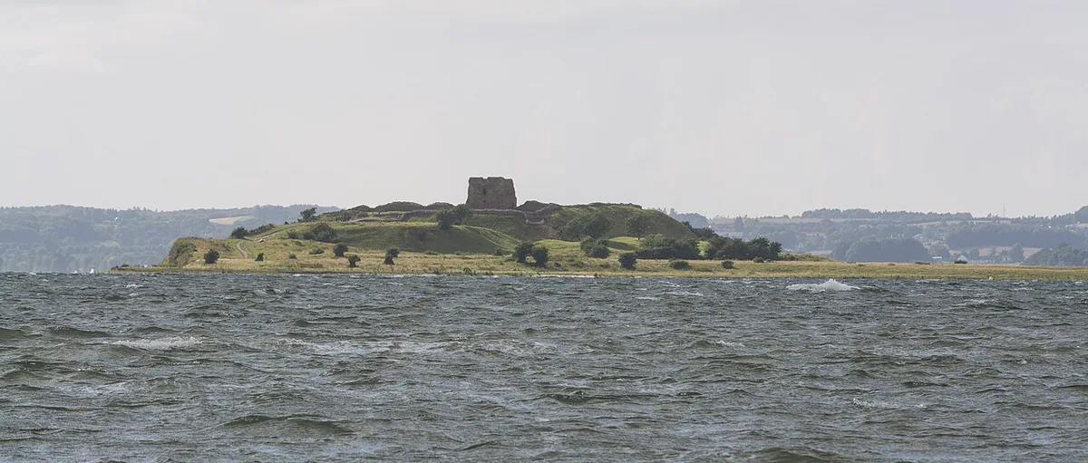
Jernhatten is the best-known coastal viewpoint. Its cliff drops 49 m to the Kattegat. Approach is by a track from the car parking area through the beech wood of Troldeskoven. From the top, the island of Hjelm lies to the southeast. Kalø Castle ruin stands on a small island and is reached along a medieval cobblestone embankment. Sources disagree on that embankment's length, so treat any figure you read as approximate. Danish news pages on the park site report a new visitor centre funded by A. P. Møller Fonden. Check current visitor-centre arrangements before you plan a stop around Karlsladen or Øvre Strandkær. Further stops are listed below.
- Kalø Castle ruin: remains of a medieval castle, reached along a cobbled embankment.
- Karlsladen: a restored 18th-century barn that serves as visitor centre for the Kalø ruin.
- Øvre Strandkær: the Nature Agency visitor centre, with a path through pine forest and grazed pasture.
- Stubbe Sø: the largest lake on Djursland, with a bird tower.
- Ørnbjerg Mølle: the only working water mill in the park, run by volunteers, with buildings dating to 1833.
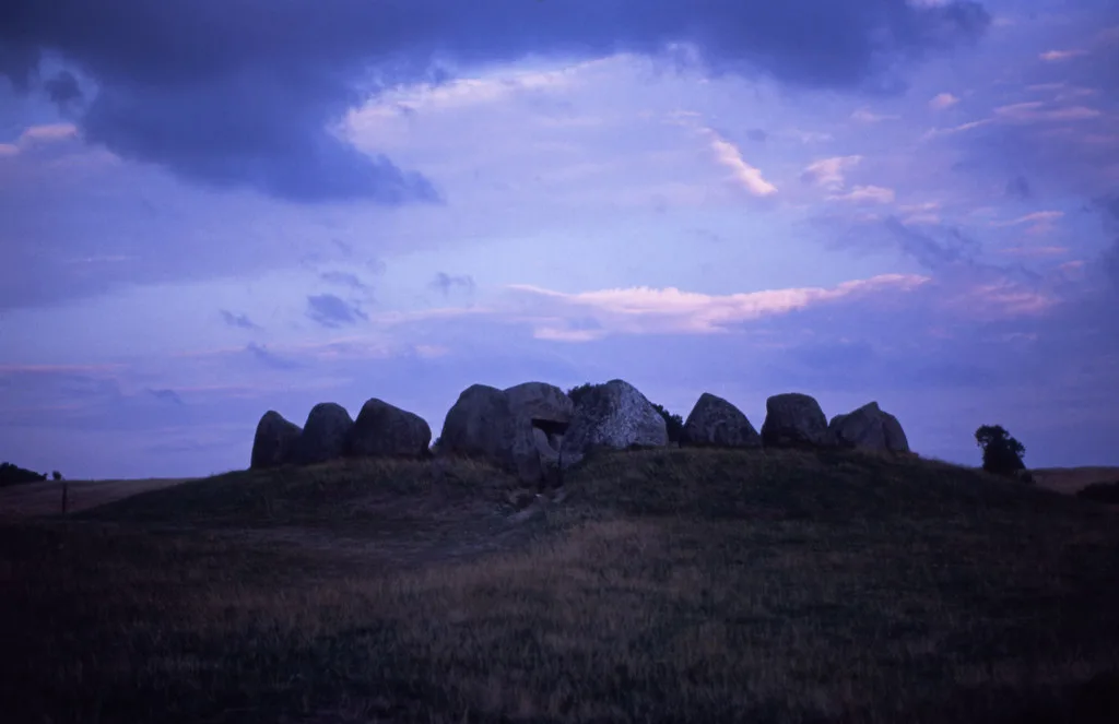
- Porskær Stenhus and the Tustrup burial mounds: prehistoric monuments close to the trail network.
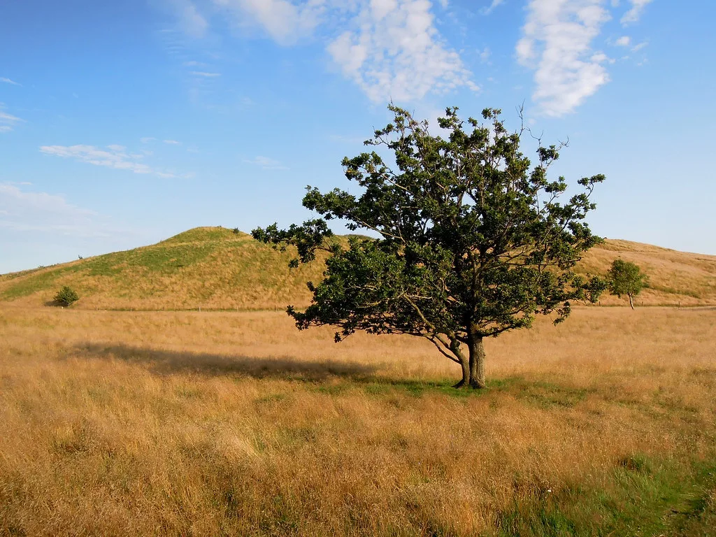
- Trehøje and Stabelhøje: Bronze Age mounds with views over the bays.
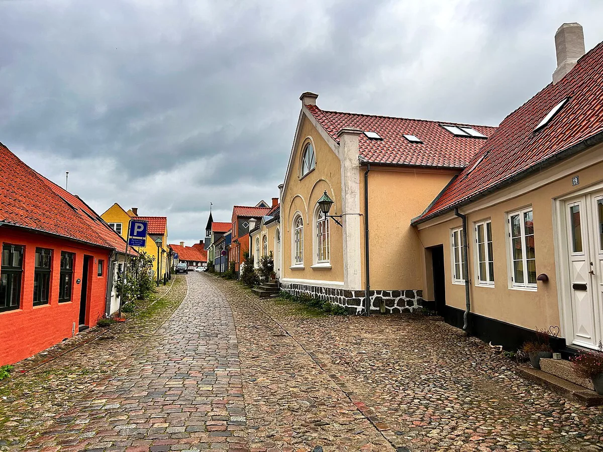
- Ebeltoft old town: cobbled streets, half-timbered houses and hollyhocks.
Nature and wildlife
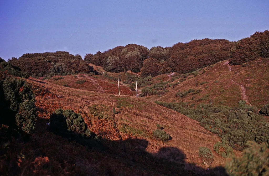
Habitats here range from heath and pasture to bogs, meadows and coast. Around 40 of Denmark's 200 conservation-worthy nature types occur in the park. Cattle, sheep and horses graze much of the open land. Their grazing keeps scrub from turning the heath into forest. At Skovbjerg, 15 hectares of old oak wood carry beef cattle at moderate levels. Possible sightings include sand lizards, red kites, roe deer and grazing horses. Harbour porpoises may show off the Jernhatten coast. Stubbe Sø bird tower is the place to watch for lake and wetland birds. Plant interest includes pasque flower, catchfly and cudweed. Sightings vary by season, so treat every animal as a bonus.
Getting there and getting around
Aarhus works as a day-trip base, and Ebeltoft is the best-known overnight base. A day trip works if you pick one anchor, such as Kalø Castle ruin plus a short wood loop. Keep the multi-day trail for a longer stay. Park secretariat's address is Grenaavej 12, 8410 Rønde. Designated parking areas are spread through the park, including one for Jernhatten. Without a car, rely on buses and your own feet. Look up current lines and stops on Midttrafik and Rejseplanen, because timetables change. From Ebeltoft you can walk to Ahl Plantation, a 110 ha coastal forest southwest of town. Wartime trenches and bunkers from the 1801–1814 war with England survive there. Visit Djursland lists current activities and visitor information. Sights such as Jernhatten, Strandkær and Ørnbjerg Mølle are easiest with a car.
Where to stay near Mols Bjerge National Park
Ebeltoft is the best-known base, with half-timbered houses and cobbled streets. Femmøller lies a few kilometres north of Strandkær and suits walkers who want to start close to the hills. VisitAarhus lists an authentic yurt at Bjørnen i Bjergene in Knebel. Booking shelters and sleeping outdoors is covered in the park's FAQ. School holidays bring more visitors, so reserve beds early for July and August.
Booking in Ebeltoft puts Ahl Plantation's 110 ha coastal forest within walking distance, along trenches from the 1801–1814 war.
When to go and what to bring
Summer 2026 programming on the official site includes sightseeing, snorkelling trips and boat trips on a historic ship. Late autumn and winter are quiet. One late-November walker reported restaurants closed but toilets open. Pack your own lunch and water. Good hiking boots matter on heath and pasture. Bring a power bank, since route apps drain batteries. Save an offline map before you set out. Volunteers carry much of the park's practical work. Park news describes volunteer groups building footbridges and picnic spots, for example at Langbjerg and the marsh at Øer. Guided tours and events can be booked through the park's booking page.
Access rules and being a good guest
Green line on the park map marks a boundary, not a fence. Ebeltoft, villages and summer-house areas count as part of the park. Nearly 33% of the park is cultivated, and about 80% of the hill area is privately owned. Park's Danish site, nationalparkmolsbjerge.dk, has a page titled 'Hvor må jeg gå?' (Where may I walk?). It also offers a leaflet on crossing fields with grazing animals. Another page gives 10 tips for being a good guest in nature. Dogs, bikes and shelters are answered in the official FAQ. Follow it rather than assumptions. Legal access rules are also explained by the Danish Nature Agency.
Common mistakes to avoid
Most problems come from small assumptions.
- Expecting mountains: the highest point is 137 m.
- Treating the map boundary as a fence: much of the land is private or farmed.
- Counting on cafés in winter: some restaurants close.
- Assuming a bus times without checking Midttrafik or Rejseplanen.
- Leaving the offline map until you are on the heath.
- Cramming the 80 km trail into one day instead of walking a section.
Is Mols Bjerge worth it? Where to go next
Hikers, history fans and slow travelers get the most from Mols Bjerge. Visitors wanting dramatic peaks may be disappointed. Prefer wild west-coast dunes? Read about Thy National Park Guide: Dunes, Coast & Trip Planning. Tidal flats are the draw at the Wadden Sea National Park. Another Danish option is Skjoldungernes Land.
Frequently Asked Questions
What are the national parks in Denmark?
Mols Bjerge, Thy and the Wadden Sea are three of them. Skjoldungernes Land and Kongernes Nordsjælland complete the mainland list.
Notes for your next park visit
Optional updates to our national park guides.
Read next
Keep planning
Picked from the same area